
A pre Christmas walk
Finely, I managed to get out to the hills and the now, for me, a well trodden walk to a rather nice bothy (shieling related or not) a couple of miles in from the head of Strathardle. Walking past the deserted farmstead of Stronhavie and taking the old Blair Atholl route that snakes up the hill. With a little corner cutting you at first come across an old wall created I think to guide livestock coming down or up to/from the main road, I suspect more down, perhaps cattle to the fair at Kirkmichael or heading further south via Glen Derby. When passing the wall this time with a low sun I noticed a very faint continuation from what I thought originally as the large stone marking the end, there is also possibly a fallen stone post, so maybe there was a gap allowing for some further redirection downslope. Anyway I’ll have to amend the DES description I submitted, though the purpose of the wall remains.
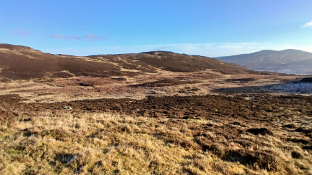 Once up the steep slope the ground flattens out and you face Crungie Dubh hill, where the bothy sits above. Its lower area I can imagine being at times a stance before the cattle were moved down to the strath.
The bothy sits above and overlooks the route for a full 180 degrees, with good visibility to distant hills. It's a perfect spot, sheltered with a crag to the north and where small pens contemporary with the bothy had been located. The bothy is well built up and has what looks like a small end byre being a later addition, in general respects a standard design. Just down from the bothy is a cracked and split boulder that forms a perfect seat, that I’m sure would have been frequently used, keeping an eye on movement or for a relaxing smoke on some pipe tobacco.
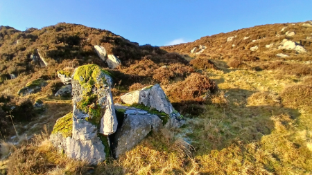 After a quick bite to eat as the temperature despite the sunshine was not conducive to sitting or standing around I decided to head back down via an alternative route that might reveal the track indicated on Roys map that skirts around Balgholan Craig by Brerachan Water. I know it’s occasionally used with a quad bike by the local farmer but it’s not obvious that this was a regularly used part of the way to and from Blair Atholl as clearly indicated on Roy’s map
The Roy route I can also not see as being used for any movement of particularly large herds of livestock as it passes right by the small settlement of Balgholan that at some point became the sheep fank, the footings of settlement buildings can still be found. Perhaps the winding road up and down via Stronhavie was a later more practical alternative and adding little to the distance. Or the dominance of sheep farming just took over. As it turned out I couldn’t discern the old Roy marked route.
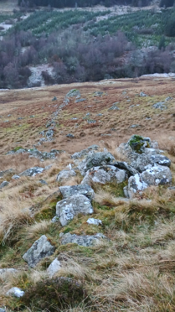 On the south face of Balgholan Craig you come across a nice lichen covered wall, the head dyke, that snakes around the hill, a gap of collapsed walling acting as a frequently used open way for animals. What is intriguing however is another near parallel but evidently a much older wall, much more ruinous and at its lower reaches towards the Brerachan Water being virtually non existent and devoid of stone walling, just a heather covered earthen dyke. Quite what the reason for a newer wall above and just extending a short distance up the hillside would need further research. Another oddity is why the older wall was not completely robbed of its stone and thus for it to cease being a barrier for animals, not that there is much left to inhibit any.
Heading further down towards the fank I came across the footings of a lone bothy with two small enclosures, though one might also have been another but much smaller bothy or small byre, there is another small enclosure nearby. None of these are recorded.
Heading down towards the fank and the track back to Stronhavie. I sense my way down hill amongst the rocks to the fank was the route people in the past might have walked even though nothing indicated it being particularly so, a ghost path.
The final stretch along the farm track and then a drive home.
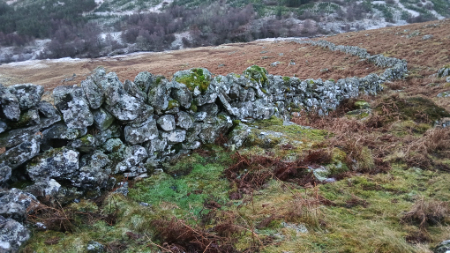

Top image; looking back towards Strathardle. Top left; a handy seat just below the bothy. Right image; the old wall looking down towards Brerachan Water. Bottom left image; the top head dyke wall. Bottom right image; grass covered footings of bothy near the Balgholan fank, looking down towards Strathardle.