
A visit to Glen Moy in search of some hut circles.
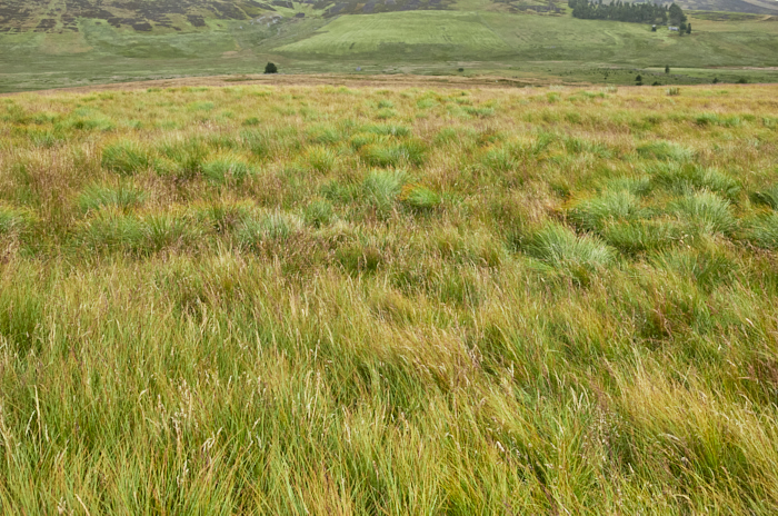 The search was for what I envisaged from the very start to be difficult to locate or rather to actually see the hut circles, unlike a lot of hut circles that are generally easy to pinpoint. These are located in Glenmoye Park, an area in Glen Moy (at the end of the public road) and just up the hill from Wester Lednathie a now much reduced farmstead and large circular enclosure, itself located in the 'Park'.
Yes the names become rather confusing and to confuse matters slightly more (such are the rabbit holes when researching) the nearby farm that was once called (1st OS map) Hindhaugh is now Glenmoy farm. The name seems to have changed around 1900 if referencing various maps.
The Wester Lednathie name (as per Trove) I think is wrong as there is a precisely named Wester Lednathie (and an Easter) and a Burn of Lednathie a mile or so west of Cortachy in Glen Uig plus no map mention to that name in the area discussed here. Of course Trove while showing interesting images of the Glenmoye Park hut circles is rubbish with regards finding informative 'Details' of what is I now realise currently being called Wester Lednathie, and the farmstead/settlement there. One would need to consult and confirm with a local or the estate owner (if interested?) for the possible correct and true name, if not just Glenmoye Park (old) farm, but it does seem odd.
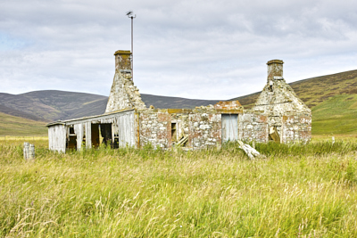
 Anyway, having parked the car at a nice small prepared parking spot (thumbs up) it is just a short walk up past Glenmoy farm, that is now empty and decaying, though the estate did try a little scam in offering people to rent it for a pound if they renovated it, just as a holiday home mind, nothing permanent. Obviously no takers. Further up the track is what might well have been a nice cottage that up until recently had a roof, the slates now stacked it was noticed by the farm. Both have or had electricity connection and TV. The little cottage could have made for a lovely holiday let if suitably renovated, or an actual home. Back down the public road is an example of a small old barn that was indeed completely renovated and turned into a very desirable property (Link)

Before the bridge by the small cottage you turn up the track to the left and then into Glenmoye Park itself, a gentle hillside of rough grazing and then head west. This will take you to the much reduced remains of the farmstead/settlement currently and incorrectly (?) called Wester Lednathie. As far as I can ascertain this has never been surveyed and the only information is just a reference to previous maps that indicate “A farmstead, comprising two unroofed buildings and one enclosure annotated 'Sheepfold' is depicted on the 1st edition of the OS 6-inch map (Forfarshire 1865, sheet xxv). A number of walls which may be part of the building and the enclosure are shown on the current edition of the OS 1:10000 map (1972).” This is very misleading as you will easily see on the ground and aerial imagery that it is in fact a very complex and extensive area with numerous buildings. Well worth exploring and trying to figure out what the buildings actually constituted, one looks like a drying kiln but also certainly several byres and of course the nice circular enclosure. There are also at least five interesting bothies just to the north, all curiously widely spaced from each other. Plus a stand alone rectangular enclosure similar to another but square enclosure that has been integrated with a boundary wall, there is the possible remains of another to the north with a possible bothy, another standalone bothy can also be seen. A line of stone shooting butts are located near to the boundary wall. This whole area would benefit and be an interesting project to survey, even if ‘just’ in part post medieval. There are several other ruinous buildings in the wider landscape (ie. Shank) and you will see that a lot of rig (ridge) and furrow cultivation has taken place in the past.

However the hut circles are much much earlier and are located with areas of enclosure a little to the north west and uphill of the farmstead. These are near impossible as I discovered to see on the ground, certainly mid summer with the long tussocky grass, though from Trove (snow cover) images (Link) and Apple Maps aerial (or here Link) they can be very faintly made out. I did ascertain what I think to be their location following the grid reference, on slightly level ground there is a hint of a depression within a vague circular area.
 The highish location looking down to the burn is interesting and that there isn’t a water source except the burn aways downhill, not even a hint of an old spring or flush adjacent, the farmstead slightly further down looks as if it had a water source though. That the huts would have stood with the full force of a north wind, as with the bothies further down the hillside is also curious, offering no shelter. There are a few tree stumps nearby from a former woodland (Glenmoye Park Wood, circa 1900) but what the tree coverage there was and shelter from in past times is questionable.
It appears from the various photo sources that there are two large huts and possibly others much smaller. LiDar when it gets done should reveal a lot more information on this location as a whole.
Glenmoye Park is an interesting area and for a bit more energy you can pop over the hill to another ruinous settlement called Cuilt named on Timothy Ponts map of 1600 (as Cult) or the more contemporary farmstead Glencuilt, then walk back the adjacent track that takes you to the public road. Option of course to do this clockwise.
The hills around are bleak and extensively scarred by muirburn but still an area well worth a trip to locate the archaeology and evidence of past lives for yourselves.
Images (from top): Location of hut circle, Estate track into Glen Moy, Glen Moy farmhouse, Gable end of cottage in Glen Moy, Roofless cottage in Glen Moy.